It’s common wisdom that you should release a software product when it is minimally viable: get an early version out in the world as soon as it can perform a useful task for a customer.
When that product is for someone who is a developer that’s been coding since the dawn of time, the equation gets flipped on its head. Waterscope is a Maximally Viable Product™ and the customer is me.
The app got its start when Swift 1.0 was announced back in 2014: I wanted to build something with the new language. About that same time, I had also started learning about tides and how they are predicted. It’s a complex problem that has been vexing scientists since the three-body problem was first proposed by Newton with the publication of the Principia in 1687. Like determining the time and place for a lunar eclipse, we rely on derived approximations.
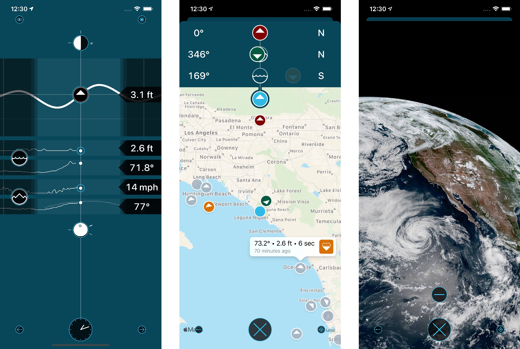
For learning a new language, tide prediction provided a lot of interesting work: data collection, complex calculations, graphical presentation, and animatable data. It also let me know when it was a good time for a dog walk.
As an ocean swimmer, I also wanted my weather app to provide information about water conditions. It turns out the scientists at the National Oceanic and Atmospheric Administration (NOAA) have that all figured out. As do the meteorologists at the National Weather Service (NWS) with their API for weather observations and forecasts. There are even high resolution images from environmental satellites launched by NASA. The United States government provides a treasure trove of data; the challenge with Waterscope was to organize and present it in a consistent manner.
Which leads to a secondary goal for this app: to make it completely by myself. I work with some incredibly talented designers, but I wanted Waterscope to be uniquely my own. All the design, for better or worse, was created by my own hand. (The only exception is the use of SF Symbols when showing weather conditions.)
So not only was I learning Swift, I was also learning Sketch and, of course, how much time it takes to get something to feel right. Like coding, it’s not as easy as we sometimes make it look. Don’t take your designers for granted :-)
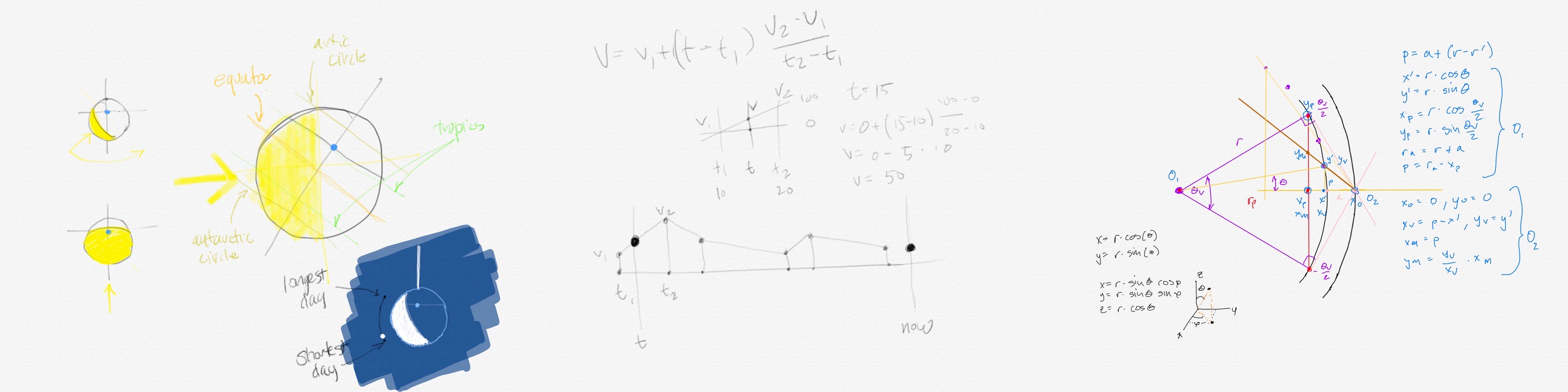
Along the way, there were some interesting hurdles. Some visual, some simple, and some complex. Many of the things I wanted to do required learning about astronomy and orbital mechanics. My sketches from Linea will give you an idea of the breadth of the challenges. (And being the day after the solstice, that first sketch is particularly relevant.)
Here I am, six years later. I’ve learned a lot, but as with my first app in Objective-C, the most important thing about this exercise was how not to use Swift. It will probably take me another 18 years to come to terms with this new language, and feel like I’ve mastered it, but a journey can’t start without the first steps. Another insight is that a programming language is just a means to an end: the hard part is not the code, it’s understanding what needs to be done.
I’m releasing Waterscope today because there are certainly other folks who will benefit from my personal weather app. There may even be some educational value in seeing how I approached a data-rich user interface (hint: Edward Tufte’s books taught me). Information can be dynamic and beautiful.
At the same time, if you’re outside the U.S., it’s unlikely to be a satisfying experience: most of the data sources and their presentation are oriented towards North America. An example: in the southern hemisphere your view of the sun and moon’s orbit is in a counterclockwise direction as you look north. Waterscope displays a clockwise orbit.
But the good news is that Waterscope, like the data it uses, is FREE to download and use. Enjoy!